Securing the Skies: How UAVs Stay on Course Against GNSS Threats
Unmanned Aerial Vehicles (UAVs) have revolutionized industries, from agriculture to defence, with their ability to navigate autonomously, collect real-time data, and execute critical missions.
At the core of their success lies GNSS (Global Navigation Satellite System); an umbrella term for satellite-based navigation systems (like GPS, GLONASS, Galileo, and BeiDou) that provide global positioning (latitude, longitude, and altitude), timing (time synchronization, essential for telecommunications), and velocity data (how fast the vehicle is and the direction of movement). GNSS can also be used in combination with other technologies like Inertial Measurement Units (IMUs) for improved accuracy and dependability. Check our blog for more information on IMU technology.
Whether surveying farmland, securing borders, or conducting military strikes, GNSS plays a crucial role in ensuring UAVs operate with accuracy and efficiency.
GNSS provides:
- Stable flight paths and autonomous navigation
- Accurate georeferencing which is essential for photogrammetry and terrain modeling in mapping, surveying, and precision agriculture applications
- Real-time positioning for BVLOS (Beyond Visual Line of Sight) Operations for long flights without direct pilot control
- Safety features such as Return-to-Home (RTH) in case of signal loss or low battery.
These features advance UAV usage in operations including; border patrol and security, reconnaissance and surveillance, and search and rescue aid. While GNSS technology becomes increasingly helpful for such critical missions, it is also vulnerable to interference that can disrupt operations, particularly in high-risk environments. RF interference, whether intentional or unintentional, can spread over hundreds of kilometers, even affecting UAVs far from conflict zones; especially areas unobstructed by trees, buildings, lakes, rivers, and other water bodies. Read our blog for more information on the risks of jamming and spoofing.
To ensure reliable performance, advanced anti-jamming and anti-spoofing technologies are becoming integral to UAV GNS Systems.
GNSS jamming occurs when powerful radio signals override the weak satellite signals received by a UAV. This can result in navigation failure, causing UAVs to lose their positioning data or even enter unsafe flight modes. Jamming can be caused by electronic warfare tactics, self-interference from onboard systems, or even unintentional sources such as telecommunications equipment.
On the other hand, GNSS spoofing is a more sophisticated cyber threat where a malicious actor transmits false satellite signals to deceive a UAV’s navigation system. Unlike jamming, which simply blocks signals, spoofing manipulates a UAV’s positioning data, potentially diverting it off course or making it believe it is somewhere it is not. This poses a significant security risk, especially for UAVs used in military, security, and critical infrastructure applications.
The Future of Secure UAV Navigation
As UAV operations expand into more complex environments, robust anti-jamming and anti-spoofing technologies will be critical for ensuring mission success.
Septentrio’s AIM+ and similar innovations provide UAVs with the resilience needed to navigate safely, whether in conflict zones, border security operations, or commercial applications where GNSS reliability is paramount.
AIM+ anti-jamming technology enhances notch filtering techniques and algorithms to protect Septentrio receivers from any interference. AIM+ anti-spoofing technology mitigates spoofing attacks and alerts the UAV to provide situational awareness.
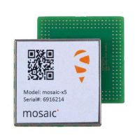
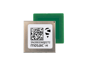
Septentrio’s Mosaic-x5 and Mosaic-H GNSS receiver modules are capable of tracking all GNSS constellations supporting current and future signals with built-in AIM+ technology.
Mosaic-X5 is small in size yet big in reliability and scalable position accuracy. With a wide array of interfaces, it is a great fit for mass-market applications for UAVs. It delivers RTK positioning with the lowest power consumption among similar devices on the market.

Mosaic-H offers precise heading and centimeter-level RTK positioning with dual-antenna GNSS. This compact solution provides instant heading & pitch/roll data from startup, reducing power use and avoiding interference from metal, unlike magnet-based sensors.

Septentrio’s Mosaic-go and Mosaic-go heading evaluation kits offer the ideal solution for testing and integrating GNSS technology into your UAV systems. Mosaic-go heading evaluation kit adds dual-antenna support for precise heading, pitch, and roll measurements, ideal for applications requiring accurate orientation and navigation.
By integrating these advanced technologies, UAVs can continue to operate with precision, security, and confidence, regardless of the challenges posed by RF interference.
SACA Europe is a trusted distributor of Septentrio’s wide range of reliable high-accuracy positioning solutions. We are here to guide your projects with Septentrio’s innovative portfolio:
https://www.sacaeurope.com/products/septentrio/